Maryland Hts' Livability
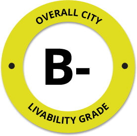
-
C
Affordability -
B-
Housing -
B
Job Market -
A-
Diversity -
C+
Crime -
B+
Commute -
C+
Education -
B-
Weather -
A
Amenities
About Maryland Hts, MO
Maryland Hts, MO is located in St. Louis County in the state of Missouri.
The total City Population for Maryland Hts is about 22,367 with about 1,579 people per square mile.
The Average Home Value is $157,300, which is roughly 14% higher than the Average Home Value of $135,153 for the state of Missouri, and roughly 28% lower than the National Average of $217,072.
The Median Income Per Household is about $68,556, which is roughly 21% higher than the Average Median Income Per Household of $54,319 for the state of Missouri, and roughly 5% higher higher than the National Average of $65,026.


Quick Stats
Demographic Details
Average # of People Per Household: 2.31Male Population Estimate: 48.9%
Female Population Estimate: 51.1%
Median Age: 38.2
Male Median Age: 36.1
Female Median Age: 40.4
Racial Demographic Estimates
Asian:10.63%
Black:10.59%
Hispanic:3.52%
Other:2.1%
Indian:0.67%
Hawaiian:0.15%
Voting


Voting Results by Party
Republican: 37.19%
Libertarian: 1.14%
Green: 0.34%
Other: 0.16%
Crime Details
NOTE: Crime is available at the County level so this doesn't necessarily represent the city of Maryland Hts specifically.
Average # of Homicides for St. Louis County: About 12.7411 per 100,000 People
(last recorded in 2021)
Average # of Violent Crimes for St. Louis County: About 344.487 per 100,000 People
(last recorded in 2021)
St. Louis County is about 69% higher than the national average of about 4 homicides per 100,000 people, and about 16% higher than the national average of about 288 violent crimes per 100,000 people.
Employment
The Unemployment Rate for Maryland Hts is about 2.7%.
Missouri is ranked #31 out of 52 for Best and Worst States to Work in America, with an overall score of 38.26 out of 100.

Wage Policies
Overall Wage Policy Score: 43.58The average living wage for the state of Missouri is $31.55/hr, while the states minimum wage is $10.30/hr, which can be set above the state standard, and is extended to farm workers. This gives Missouri a minimum wage score of 56.09 compared to all other states.
The minimum wage for tipped employees is $5.15/hr, which gives Missouri a minimum wage for tipped employees score of 35.55 compared to all other states.
The weekly unemployment (UI) benefit for Missouri is $214.24, resulting in a UI benefit score of 47.41 compared to all other states.
Worker Protection Policies
Overall Worker Protection Score: 71.43X Missouri does offer protections for workplace breastfeeding.
✓ Missouri does mandate equal pay across gender and race.
X Missouri does prohibit pay secrecy practices in the workplace.
✓ Missouri does restrict access to salary history to reduce gender and racial bias.
X Missouri does provide some form of paid family leave.
X Missouri does provide some form of paid sick leave.
X Missouri does not provide flexible scheduling of worker shifts.
X Missouri does not mandate pay reporting or "call-in" pay by employers.
X Missouri does not provide split shift pay regulation.
X Missouri does not provide workers advanced notice of shift scheduling.
✓ Missouri does provide some form of sexual harassment protection in state law.
X Missouri does extend workers compensation mandates to farmworkers.
X Missouri does not extend worker protections to domestic workers.
Right To Organize Policies
Overall Right To Organize Score: 70X Missouri does legalize project labor agreements to ensure a fair wage to workers on contract.
X Missouri does not protect workers against wage theft retaliation.
✓ Missouri does partially require collective bargaining for public workers.
✓ Missouri does provide collective bargaining for teachers.
✓ Missouri does provide wage negotiations for teachers.
A global organization that fights inequality to end poverty and injustice.
Nearby Location
- Vigus, MO ( 0.59 mi. )
- Champ, MO ( 0.98 mi. )
- Maryland Heights, MO ( 1.32 mi. )
- Earth City, MO ( 2.71 mi. )
- Bridgeton, MO ( 2.94 mi. )
- Bridgeton Terrace, MO ( 3.04 mi. )
- Saint Ann, MO ( 3.60 mi. )
- Northwest Plaza, MO ( 3.60 mi. )
- Nw Plaza, MO ( 3.60 mi. )
- Saint Anne, MO ( 3.60 mi. )
- St Anne, MO ( 3.60 mi. )
- St Peters, MO ( 4.16 mi. )
- Robertson, MO ( 4.58 mi. )
- Creve Coeur, MO ( 4.80 mi. )
- Breckenridge Hills, MO ( 4.82 mi. )
- Edmundson, MO ( 4.85 mi. )
- Woodson Terrace, MO ( 5.16 mi. )
- Overland, MO ( 5.24 mi. )
- Brecknrdg Hls, MO ( 5.52 mi. )
- Vinita Terrace, MO ( 5.52 mi. )
- Hazelwood, MO ( 5.57 mi. )
- Olivette, MO ( 5.79 mi. )
- Twn And Cntry, MO ( 5.81 mi. )
- Sycamore Hills, MO ( 6.10 mi. )
- Westwood, MO ( 6.15 mi. )
- Charlack, MO ( 6.39 mi. )
- Berkeley, MO ( 6.50 mi. )
- Harvester, MO ( 6.81 mi. )
- Vinita Park, MO ( 6.92 mi. )
- Town and Country, MO ( 6.96 mi. )
- Kinloch, MO ( 7.06 mi. )
- Frontenac, MO ( 7.23 mi. )
- Flor, MO ( 7.28 mi. )
- Country Life Acres, MO ( 7.50 mi. )
- Ladue, MO ( 7.57 mi. )
- Crystal Lake Park, MO ( 7.68 mi. )
- Hanley Hills, MO ( 7.70 mi. )
- University City, MO ( 8.06 mi. )
- Cool Valley, MO ( 8.08 mi. )
- Greendale, MO ( 8.13 mi. )
- Calverton Park, MO ( 8.19 mi. )
- Chesterfield, MO ( 8.35 mi. )
- Bel Nor, MO ( 8.38 mi. )
- Bel Ridge, MO ( 8.38 mi. )
- Bellerive, MO ( 8.38 mi. )
- Glen Echo Pk, MO ( 8.38 mi. )
- Florissant, MO ( 8.40 mi. )
- Burke City, MO ( 8.44 mi. )
- U City, MO ( 8.48 mi. )
Additional Location Details
Zip Code(s): 63043Latitude: 38.730854
Longitude: -90.455710
TimeZone: Central (GMT -06:00)
Daylight Saving: Yes
Region: Midwest
Average Elevation: 482.0 ft.
Area Code(s): 314, 636