Danville's Livability
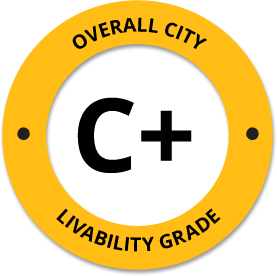
-
F
Affordability -
B
Housing -
C-
Job Market -
B
Diversity -
C+
Crime -
C+
Commute -
A
Education -
A-
Weather -
B+
Amenities
About Danville, CA
Danville, CA is located in Contra Costa County in the state of California.
The total City Population for Danville is about 43,673 with about 960 people per square mile.
The Average Home Value is $1,252,920, which is roughly 53% higher than the Average Home Value of $588,722 for the state of California, and roughly 83% higher than the National Average of $217,072.
The Median Income Per Household is about $181,453, which is roughly 54% higher than the Average Median Income Per Household of $83,076 for the state of California, and roughly 64% higher higher than the National Average of $65,026.


Quick Stats
Demographic Details
Average # of People Per Household: 2.84Male Population Estimate: 49.5%
Female Population Estimate: 50.5%
Median Age: 46.9
Male Median Age: 43.9
Female Median Age: 44.3
Racial Demographic Estimates
Asian:15.5%
Hispanic:6.6%
Other:1.2%
Black:0.6%
Indian:0.6%
Hawaiian:0.1%
Voting


Voting Results by Party
Republican: 26.3%
Libertarian: 1.05%
Other: 0.57%
Green: 0.45%
Crime Details
NOTE: Crime is available at the County level so this doesn't necessarily represent the city of Danville specifically.
Average # of Homicides for Contra Costa County: About 5.63231 per 100,000 People
(last recorded in 2021)
Average # of Violent Crimes for Contra Costa County: About 336.028 per 100,000 People
(last recorded in 2021)
Contra Costa County is about 30% higher than the national average of about 4 homicides per 100,000 people, and about 14% higher than the national average of about 288 violent crimes per 100,000 people.
Employment
The Unemployment Rate for Danville is about 4.3%.
California is ranked #4 out of 52 for Best and Worst States to Work in America, with an overall score of 84.2 out of 100.

Wage Policies
Overall Wage Policy Score: 66.74The average living wage for the state of California is $40.83/hr, while the states minimum wage is $13.00/hr, which can be set above the state standard, and is extended to farm workers. This gives California a minimum wage score of 51.89 compared to all other states.
The minimum wage for tipped employees is $13.00/hr, which gives California a minimum wage for tipped employees score of 100 compared to all other states.
The weekly unemployment (UI) benefit for California is $260.00, resulting in a UI benefit score of 39.13 compared to all other states.
Worker Protection Policies
Overall Worker Protection Score: 71.43✓ California does offer protections for workplace breastfeeding.
✓ California does mandate equal pay across gender and race.
✓ California does prohibit pay secrecy practices in the workplace.
✓ California does restrict access to salary history to reduce gender and racial bias.
✓ California does provide some form of paid family leave.
✓ California does provide some form of paid sick leave.
X California does not provide flexible scheduling of worker shifts.
✓ California does not mandate pay reporting or "call-in" pay by employers.
✓ California does not provide split shift pay regulation.
X California does not provide workers advanced notice of shift scheduling.
✓ California does provide some form of sexual harassment protection in state law.
✓ California does extend workers compensation mandates to farmworkers.
✓ California does not extend worker protections to domestic workers.
Right To Organize Policies
Overall Right To Organize Score: 70✓ California does legalize project labor agreements to ensure a fair wage to workers on contract.
✓ California does not protect workers against wage theft retaliation.
✓ California does partially require collective bargaining for public workers.
✓ California does provide collective bargaining for teachers.
✓ California does provide wage negotiations for teachers.
A global organization that fights inequality to end poverty and injustice.
Nearby Location
- Diablo, CA ( 2.11 mi. )
- Blackhawk, CA ( 3.43 mi. )
- Alamo, CA ( 3.79 mi. )
- San Ramon, CA ( 3.88 mi. )
- San Miguel, CA ( 6.31 mi. )
- Walnut Creek, CA ( 7.31 mi. )
- Dublin, CA ( 7.75 mi. )
- Moraga, CA ( 8.61 mi. )
- Castro Valley, CA ( 8.75 mi. )
- Clayton, CA ( 9.12 mi. )
- Lafayette, CA ( 9.82 mi. )
- Concord, CA ( 11.19 mi. )
- Pleasanton, CA ( 11.19 mi. )
- Pleasant Hill, CA ( 11.37 mi. )
- Mount Eden, CA ( 11.58 mi. )
- Chevron, CA ( 11.94 mi. )
- Chevron Usa Inc, CA ( 11.94 mi. )
- Canyon, CA ( 11.96 mi. )
- Orinda, CA ( 12.35 mi. )
- San Leandro, CA ( 12.65 mi. )
- San Lorenzo, CA ( 13.09 mi. )
- Pacheco, CA ( 13.30 mi. )
- Oakland, CA ( 13.55 mi. )
- Hayward, CA ( 13.69 mi. )
- Port Chicago, CA ( 13.82 mi. )
- West Pittsburg, CA ( 13.82 mi. )
- Piedmont, CA ( 14.22 mi. )
- Livermore, CA ( 14.32 mi. )
- Union City, CA ( 14.66 mi. )
- Pittsburg, CA ( 14.78 mi. )
- Antioch, CA ( 14.90 mi. )
- Clyde, CA ( 15.06 mi. )
- Briones, CA ( 15.11 mi. )
- Martinez, CA ( 15.14 mi. )
- Bay Point, CA ( 15.25 mi. )
- Sunol, CA ( 16.02 mi. )
- Brentwood, CA ( 16.11 mi. )
- UC Berkeley, CA ( 16.12 mi. )
- Philatelic Center, CA ( 16.24 mi. )
- Blue Cross, CA ( 16.38 mi. )
- Ebmud, CA ( 16.38 mi. )
- Kaiser Services, CA ( 16.38 mi. )
- Oakland Intrntl Service Ctr, CA ( 16.38 mi. )
- Safeway Stores, CA ( 16.38 mi. )
- Alameda, CA ( 16.52 mi. )
- Alameda Pt, CA ( 17.05 mi. )
- Berkeley, CA ( 17.20 mi. )
- Emeryville, CA ( 17.73 mi. )
- Kensington, CA ( 18.19 mi. )
Additional Location Details
Zip Code(s): 94506, 94526 (2 Total Zip Codes)Latitude: 37.812100
Longitude: -121.969800
TimeZone: Pacific (GMT -08:00)
Daylight Saving: Yes
Region: West
Average Elevation: 754.0 ft.
Area Code(s): 925