Little Rock's Livability
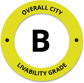
-
C+
Affordability -
A+
Housing -
B
Job Market -
B
Diversity -
C-
Crime -
A-
Commute -
C-
Education -
B
Weather -
A+
Amenities
About Little Rock, AR
Little Rock, AR is located in Pulaski County in the state of Arkansas.
The total City Population for Little Rock is about 201,893 with about 637 people per square mile, and the larger Metro Area Population is about 457,379.
The Average Home Value is $180,250, which is roughly 42% higher than the Average Home Value of $104,207 for the state of Arkansas, and roughly 17% lower than the National Average of $217,072.
The Median Income Per Household is about $56,928, which is roughly 20% higher than the Average Median Income Per Household of $45,376 for the state of Arkansas, and roughly 12% lower higher than the National Average of $65,026.


Quick Stats
Demographic Details
Average # of People Per Household: 1.02Male Population Estimate: 47.4%
Female Population Estimate: 52.6%
Median Age: 36.7
Male Median Age: 17.1
Female Median Age: 18.1
Racial Demographic Estimates
Black:41.2%
Hispanic:7.8%
Other:3.3%
Asian:3.1%
Indian:0.4%
Hawaiian:0.1%
Voting


Voting Results by Party
Republican: 37.47%
Other: 1.3%
Libertarian: 0.98%
Green: 0.26%
Crime Details
NOTE: Crime is available at the County level so this doesn't necessarily represent the city of Little Rock specifically.
Average # of Homicides for Pulaski County: About 15.6452 per 100,000 People
(last recorded in 2021)
Average # of Violent Crimes for Pulaski County: About 1059.63 per 100,000 People
(last recorded in 2021)
Pulaski County is about 75% higher than the national average of about 4 homicides per 100,000 people, and about 73% higher than the national average of about 288 violent crimes per 100,000 people.
Employment
The Unemployment Rate for Little Rock is about 4.5%.
Arkansas is ranked #34 out of 52 for Best and Worst States to Work in America, with an overall score of 30.43 out of 100.

Wage Policies
Overall Wage Policy Score: 46.91The average living wage for the state of Arkansas is $30.85/hr, while the states minimum wage is $11.00/hr, which can be set above the state standard, and is extended to farm workers. This gives Arkansas a minimum wage score of 71.73 compared to all other states.
The minimum wage for tipped employees is $2.63/hr, which gives Arkansas a minimum wage for tipped employees score of 1.92 compared to all other states.
The weekly unemployment (UI) benefit for Arkansas is $220.00, resulting in a UI benefit score of 54.07 compared to all other states.
Worker Protection Policies
Overall Worker Protection Score: 71.43✓ Arkansas does offer protections for workplace breastfeeding.
✓ Arkansas does mandate equal pay across gender and race.
X Arkansas does prohibit pay secrecy practices in the workplace.
X Arkansas does restrict access to salary history to reduce gender and racial bias.
X Arkansas does provide some form of paid family leave.
X Arkansas does provide some form of paid sick leave.
X Arkansas does not provide flexible scheduling of worker shifts.
X Arkansas does not mandate pay reporting or "call-in" pay by employers.
X Arkansas does not provide split shift pay regulation.
X Arkansas does not provide workers advanced notice of shift scheduling.
✓ Arkansas does provide some form of sexual harassment protection in state law.
X Arkansas does extend workers compensation mandates to farmworkers.
X Arkansas does not extend worker protections to domestic workers.
Right To Organize Policies
Overall Right To Organize Score: 70X Arkansas does legalize project labor agreements to ensure a fair wage to workers on contract.
X Arkansas does not protect workers against wage theft retaliation.
X Arkansas does partially require collective bargaining for public workers.
✓ Arkansas does provide collective bargaining for teachers.
X Arkansas does provide wage negotiations for teachers.
A global organization that fights inequality to end poverty and injustice.
Nearby Location
- Bba Solutions, AR ( 1.93 mi. )
- Cammack Vlg, AR ( 3.61 mi. )
- Cammack Village, AR ( 3.88 mi. )
- Mabelvale, AR ( 5.14 mi. )
- Veterans Admin Fac, AR ( 6.16 mi. )
- Veterans Administration Faci, AR ( 6.16 mi. )
- Crystal Hill, AR ( 6.50 mi. )
- Sweet Home, AR ( 7.36 mi. )
- College Sta, AR ( 7.37 mi. )
- Genevia, AR ( 7.37 mi. )
- College Station, AR ( 7.39 mi. )
- North Little Rock, AR ( 7.83 mi. )
- Jeffery, AR ( 8.34 mi. )
- Shannon Hills, AR ( 8.41 mi. )
- Maumelle, AR ( 9.06 mi. )
- Alexander, AR ( 9.10 mi. )
- Marche, AR ( 9.52 mi. )
- N Little Rock, AR ( 9.82 mi. )
- No Little Rock, AR ( 9.82 mi. )
- Royal Oak, AR ( 10.01 mi. )
- Blue Hill, AR ( 10.13 mi. )
- McAlmont, AR ( 10.27 mi. )
- Pinnacle, AR ( 10.48 mi. )
- Tafton, AR ( 10.66 mi. )
- Bryant, AR ( 10.76 mi. )
- West Marche, AR ( 11.06 mi. )
- Wrightsville, AR ( 11.39 mi. )
- East End, AR ( 11.89 mi. )
- Natural Steps, AR ( 12.24 mi. )
- N L R, AR ( 12.26 mi. )
- N LR, AR ( 12.26 mi. )
- Nlr, AR ( 12.26 mi. )
- Sherwood, AR ( 12.32 mi. )
- Rixey, AR ( 12.39 mi. )
- Tafton Wrightville, AR ( 12.74 mi. )
- Baucum, AR ( 12.92 mi. )
- Salem, AR ( 13.25 mi. )
- Northpoint, AR ( 13.35 mi. )
- Galloway, AR ( 13.51 mi. )
- Bauxite, AR ( 13.96 mi. )
- Lakeside, AR ( 14.05 mi. )
- Woodson, AR ( 15.10 mi. )
- Scott, AR ( 15.11 mi. )
- Roland, AR ( 15.13 mi. )
- Benton, AR ( 15.86 mi. )
- Jacksonville, AR ( 16.76 mi. )
- Hamiter, AR ( 17.05 mi. )
- Mayflower, AR ( 17.19 mi. )
- Macon, AR ( 17.20 mi. )
Additional Location Details
Zip Code(s): 72103, 72201, 72202, 72204, 72205, 72206, 72207, 72209, 72210, 72211, 72212, 72215, 72217, 72219, 72222, 72223, 72225, 72227, 72231, 72255, 72260, 72295 (22 Total Zip Codes)Latitude: 34.725600
Longitude: -92.357700
TimeZone: Central (GMT -06:00)
Daylight Saving: Yes
Region: South
Average Elevation: 379.8 ft.
Area Code(s): 501